theme: social_physics
SYMAP
1966
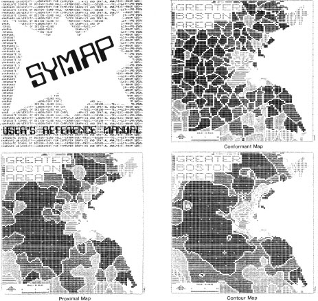
Three basic map types from the cover of the symap manual: conformant, proximal, and contour.
(Chrisman, 2006)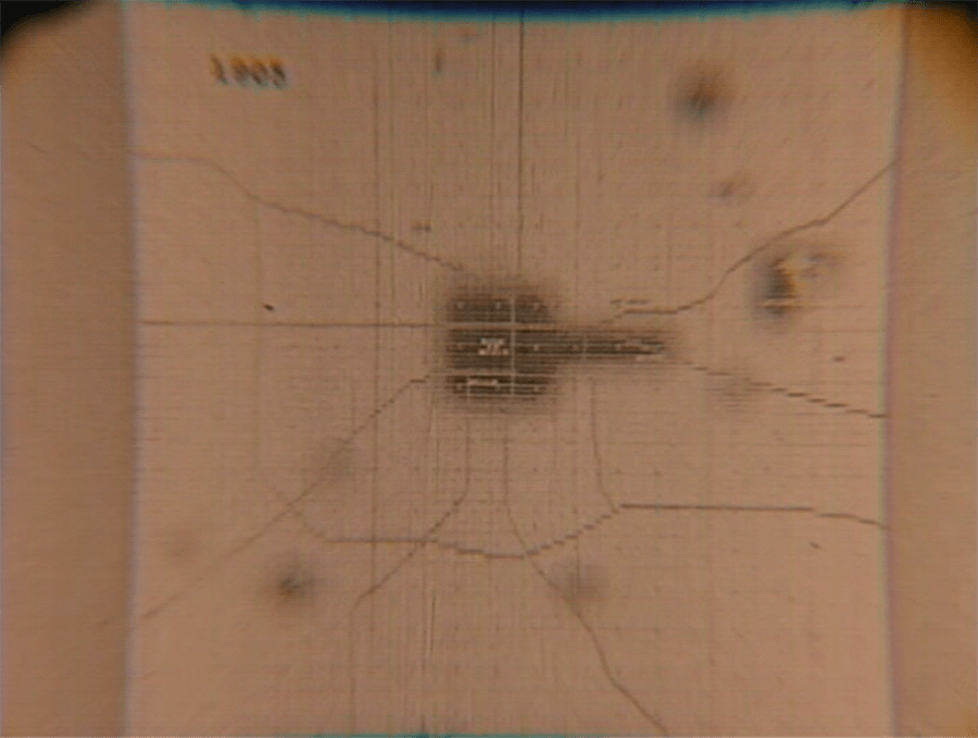
'This may be the earliest attempt to use automated cartography to display dynamic spatial information. The movie portrays the urban expansion of Lansing, MI where Schmidt was working at the Michigan State University Urban Regional Research Institute. Data for every property from 1850 to 1965 was coded by square mile section of the Public Land Survey System. To produce the SYMAP output, a thematic attribute was generated of the cumulative percent of land developed during each five year period. Each annual SYMAP output formed a square about two feet by two feet. Hung in front of a movie camera a set of frames were photographed. The sequence starts with a slow version of two minutes forty-five seconds. Then it repeats the sequence more rapidly in forty-five seconds, and finally in five seconds. The production values may not be great (the maps fade in and out of focus), but the film represents a milstone in the development of thematic cartography. '
(Schmidt, 1967)Allan H. Schmidt (1967) A Pictorial History of the Expansion of the Lansing, MI Metropolitan Area using "SYMAP" time-lapse. Harvard University Lab For Computer Graphics and Spatial Analysis [link]
Chrisman, N. R. (2006) Charting the Unknown; How Computer Mapping at Harvard Became GIS. Esri Press.
theme: social_physics